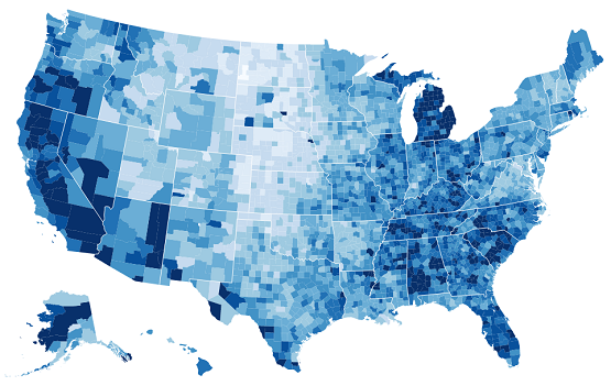
Interactive Water Use Map and Bar Chart
By Jeremiah Lant using D3.js
Kentucky
4330 mgd
Water withdrawals, in million gallons per day
Description
An interactive map of estimated water use by state during the year 2010. The data is provided by the United States Geological Survey (USGS) and can be found at USGS Water Use in the United States. The report, Estimated Use of Water in the United States in 2010, describes the purpose and scope along with the sources of data and methods of analysis. The choropleth map and bar chart show total water withdrawls by state in units of million gallons per day (mgd). The map was built using D3.js, a javascript library used for data visualization.